🎯 The ULTIMATE Latitude and Longitude Teaching Resource Bundle!
View Sample PDF Here
latitude_and_longitude_preview
Stop map illiteracy—start spatial mastery! This isn’t just a collection; it’s a powerful, cohesive geographical learning experience crafted to ignite curiosity and deepen understanding of Earth’s grid system, coordinate plotting, and global navigation for every student. Our bundle truly helps teachers, students, parents, and administrators by providing a structured, easy-to-implement framework that promotes measurable progress and fosters a love for cartography.
✅ What’s Included in this Essential Bundle?
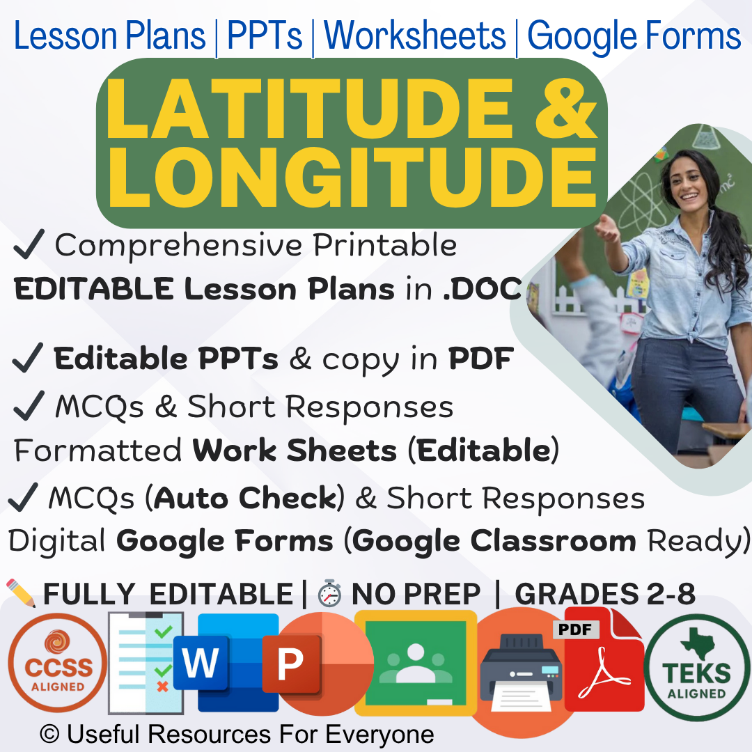
16 Editable Lesson Plans (17 pages, .DOC format): Dive deep into defining and locating the Equator, Prime Meridian, hemispheres, and coordinate pairs with meticulously detailed plans covering Learning Objectives, Teaching Methodology, Spatial Reasoning Activities, Hands-on Activities (e.g., plotting coordinates on global maps, treasure hunts using GPS/grid systems, calculating time zone differences), and Thought-Provoking Homework. These plans are your roadmap to success, ensuring a seamless and effective instructional journey through foundational map skills.
Editable PPT Slides (also in PDF): Visually captivate your students with stunning, HD, high-quality images (3D globe views, detailed map projections, and visual aids) that bring abstract grid lines and global relationships to life. These adaptable and adjustable slides are perfect for different classes and grades, ensuring dynamic presentations that reinforce key concepts and spark lively discussions about geography and navigation.
20 MCQs Worksheet (30 pages, .DOC & PDF, Answer Key): Assess understanding of key terms (e.g., parallels, meridians, hemispheres) and accurate identification of coordinates with well-formatted, editable multiple-choice questions designed for quick checks and comprehensive evaluations.
20 Short Response Question Worksheet (20 pages, .DOC & PDF, Answer Key): Encourage critical thinking and deeper analysis with thought-provoking short response questions focused on explaining why latitude and longitude are essential for navigation or justifying the location of a specific coordinate. These editable worksheets promote comprehension and written expression.
✨ Key Features & Benefits:
FULLY EDITABLE: Customize every document to perfectly fit your students’ grade level (Elementary through Middle School Geography/Social Studies) and adapt activities for different map resources.
ZERO PREP REQUIRED: Save hours of planning and material creation time—ready to teach the entire coordinate system unit immediately!
MAP SKILLS CORE: Crucial resource for building essential literacy in cartography, geometry, and global awareness.
COMPREHENSIVE UNIT: Covers all foundational concepts—lines, coordinates, hemispheres, and real-world application—across 16 detailed lessons.
STANDARDS ALIGNED: Easily aligns with Social Studies and Geography standards for spatial reasoning.
Unlock global navigation! Add this essential bundle to your cart and empower your students with the fundamental language of location!
🗣️ Buyer Feedback & Testimonials
Coordinate Mastery Achieved! 🗺️ ⭐⭐⭐⭐⭐ Mr. Jason Burke 6th Grade Social Studies Teacher Phoenix, Arizona, USA
This resource is invaluable. The 16 structured lesson plans break down the grid system into logical, easy-to-digest concepts. The Hands-on Activities, especially the plotting exercises, were immediately engaging and helped students solidify their understanding of N/S and E/W directionality. My students are now coordinate experts!
Administration Praised the Foundational Rigor ⭐⭐⭐⭐⭐ Dr. Rebecca Chen Middle School Geography Coordinator Seattle, Washington, USA
We adopted this bundle for its explicit, systematic instruction on cartography fundamentals. The clear learning objectives and the rigor of the Short Response Questions perfectly prepare students for more complex geographical analysis. An essential tool for rigorous, standards-based spatial education.
Perfect for Visual and Kinesthetic Learners ⭐⭐⭐⭐⭐ Maria Lopez 4th Grade Teacher Denver, Colorado, USA
The Editable PPT Slides effectively utilize 3D globe visualization, which is crucial for younger students. The systematic approach in the lesson plans made it easy to lead the Hands-on Treasure Hunt Activity using grid systems. This kit greatly boosted the engagement and comprehension of my entire class.
High-Quality, Engaging, and Ready-to-Teach ⭐⭐⭐⭐⭐ Professor Adam Stern Geography Education Specialist New York, New York, USA
I highly recommend this kit. The materials are high-quality, fully editable, and immediately deployable. The comprehensive coverage of all aspects of the coordinate system, including time zones, makes this an ideal resource. It truly elevates map skills instruction.
My Son Finally Understands the Global Grid ⭐⭐⭐⭐⭐ David Choi Parent/Tutor Los Angeles, California, USA
My son was struggling to keep latitude and longitude straight. The lessons in this kit, focusing on the visual difference between the two sets of lines, cleared up his confusion instantly. The practice Worksheets were excellent review. He now understands how GPS works!
Comprehensive Latitude And Longitude Teaching Resource Bundle
This isn’t just a collection of materials for Latitude And Longitude; it’s a powerful, cohesive learning experience crafted to ignite curiosity and deepen understanding for every student. Our bundle truly helps teachers, students, parents, and administrators by providing a structured, easy-to-implement framework that promotes measurable progress and fosters a love for learning.
✅ What’s Included in this Essential Bundle?
- ✅ 16 Editable Lesson Plans (17 pages, .doc format): Dive deep into each sense with **meticulously detailed plans** covering **Learning Objectives, Teaching Methodology, Brainstorming Activities, Sense Exploration, Hands-on Activities (including Lab/IT where applicable), and Thought-Provoking Homework.** These plans are your **roadmap to success**, ensuring a **seamless and effective instructional journey.**
- ✅ Editable PPT Slides (also in PDF): Visually **captivate your students** with **stunning, HD, high-quality images** (AI-generated and curated) that **bring each sense to life.** These **adaptable and adjustable** slides are perfect for different classes and grades, ensuring **dynamic presentations** that **reinforce key concepts** and **spark lively discussions.**
- ✅ 20 MCQs Worksheet (30 pages, .doc & PDF, Answer Key): **Assess understanding** with **well-formatted, editable** multiple-choice questions designed for **quick checks and comprehensive evaluations.**
- ✅ 20 Short Response Question Worksheet (20 pages, .doc & PDF, Answer Key): Encourage **critical thinking** and **deeper analysis** with **thought-provoking short response questions.** These **editable worksheets** promote **comprehension and written expression.**
✏️ Why This Resource is a Game-Changer:
- ✅ Boost Student Engagement: Our interactive activities, vibrant visuals, and dynamic presentations ensure students are active participants in their learning journey.
- ✅ Save Valuable Time: Say goodbye to endless planning and prep! This done-for-you bundle provides everything you need to teach Latitude And Longitude with confidence and ease.
- ✅ Differentiated Learning Made Easy: Resources are adaptable and adjustable to various learning styles and abilities.
- ✅ Comprehensive Coverage: From foundational concepts to advanced applications, this bundle provides a thorough overview of Latitude And Longitude.
- ✅ Assess with Confidence: Utilise multiple assessment formats to gain a holistic understanding of student comprehension.
- ✅ Parent & Admin Approved: The clear structure and detailed content make it easy to support learning at home and track progress.
- ✅ High-Quality & Professional: Enjoy meticulously crafted materials with no errors, featuring HD images.
- ✅ Flexible & Versatile: Perfect for whole-group, small-group, independent study, homework, centres, sub plans, or blended learning.
✔️ Key Features You’ll Love:
- ✅ Editable PPT Slides: Tailor content to your classroom needs.
- ✅ HD and High Quality Images: Visually stunning graphics enhance understanding.
- ✅ Adaptable & Adjustable: Easily modify for different grades and abilities.
- ✅ Comprehensive Answer Keys: Simplify grading and provide clear feedback.
- ✅ Printable & Digital Formats: Flexibility to meet your teaching style.
- ✅ Standards-Aligned Content: Covers essential curriculum objectives (NGSS, CCSS, ISTE, TEKS, STEAM).
✅ Benefits Galore!
- ✅ Time-saving: Instantly ready. Hours saved. No prep. Efficiency booster.
- ✅ Engagement: Student-centric. Interactive. Captivating. Hands-on. Curiosity builder.
- ✅ Effectiveness: Skill mastery. Deep understanding. Knowledge retention. Academic growth.
- ✅ Flexibility: Adaptable. Differentiated. Versatile. Customizable. Multi-purpose.
- ✅ Assessment: Easy grading. Progress tracking. Data-driven insights. Targeted intervention.
- ✅ Quality: Professional design. Error-free. High-resolution. Cohesive unit.
- ✅ Support: Parent involvement. Admin visibility. Teacher confidence. Student success.
- ✅ Digital Ready: Google Forms. Paperless options. Blended learning. Tech-friendly.
- ✅ Confidence: Teach with ease. Feel prepared. Expert-crafted. Proven results.
- ✅ Joy: Make learning fun. Spark interest. Inspire discovery. Memorable lessons.
🚀 TRANSFORMATIVE BENEFITS FOR EVERY STAKEHOLDER
✅ TEACHERS: Slash planning time by 15+ hours weekly with plug-and-play sensory labs and standard-aligned lesson plans, presentations & worksheet packets. Monitor progress effortlessly through self assessment trackers while engaging reluctant learners with interactive IT activities.
✅ ADMINS: Streamline IEP documentation and teacher evaluations with research-backed lesson frameworks. Achieve curriculum consistency across grade levels while meeting state science standards with ready-made pacing guides.
✅ PARENTS: Convert any home into a dynamic science lab with kitchen-friendly experiments and self-paced learning stations. Track skill mastery through progress reports mirroring classroom assessments.
✅ STUDENTS: Unlock hands-on discovery through smell/taste experiments and tactile exploration. Build critical thinking with scaffolded assignments adaptable for special needs or gifted enrichment.
📝 COPY & FEEDBACK GUIDE
Make unlimited copies at no extra cost! Use as-is or customise for personalised differentiation.
✅ No Prep ✅ Print Ready ✅ Unlimited copies ✅ 100% customizable
- #latitudeandlongitude
- #30daysofgooglecloud
- #garagegymcompetition
- latitude-and-longitude,
- reading-latitude-and-longitude-on-a-sectional-chart,
- latitude-and-longitude-on-google-maps,
- latitude-and-longitude-on-globe,
- latitude-and-longitude-on-map,
- latitude-and-longitude-on-earth,
- latitude-and-longitude-on-india-map,
- latitude-and-longitude-on-chart,
- draw-latitude-and-longitude-on-chart-paper,
- plotting-latitude-and-longitude-on-map,
- plotting-latitude-and-longitude-on-a-chart,
- latitude-and-longitude-with-degrees,
- latitude-and-longitude-song-with-lyrics,
- explain-latitude-and-longitude-with-drawing,
- latitude-and-longitude-target-with-alok,
- latitude-and-longitude-in-hindi,
- latitude-and-longitude-in-google-maps,
- latitude-and-longitude-in-udyam-registration,
- latitude-and-longitude-of-india,
- latitude-and-longitude-in-nepali,
- latitude-and-longitude-in-tamil,
- latitude-and-longitude-in-odia,
- latitude-and-longitude-in-telugu,
- latitude-and-longitude-in-malayalam,
- latitude-and-longitude-in-urdu,
- latitude-and-longitude-from-google-map,
- get-latitude-and-longitude-from-address,
- latitude-and-longitude-by-khan-sir,
- latitude-and-longitude-by-laxmidhar-sir,
- latitude-and-longitude-by-sudarshan-gurjar,
- latitude-and-longitude-by-parmar-ssc,
- latitude-and-longitude-by-digraj-singh-rajput,
- latitude-and-longitude-by-laxmidhar-sir-2025,
- latitude-and-longitude-by-shubham-gupta,
- latitude-and-longitude-by-parcham-classes,
- latitude-and-longitude-by-anirudh-malik,
- latitude-and-longitude-by-dr-binocs-in-hindi,
- latitude-and-longitude-in-english,
- latitude-and-longitude-for-kids,
- latitude-and-longitude-for-middle-school,
- latitude-and-longitude-for-class-5,
- latitude-and-longitude-for-class-9,
- latitude-and-longitude-for-bed-entrance-exam,
- latitude-and-longitude-for-nda,
- latitude-and-longitude-for-competitive-exams,
- latitude-and-longitude-for-upsc,
- latitude-and-longitude-for-ssc-cgl,
- latitude-and-longitude-for-bed-exam,
- latitude-and-longitude-in-tableau,
- latitude-and-longitude-in-bengali,
- latitude-and-longitude-in-excel,
- latitude-and-longitude-in-autocad,
- latitude-and-longitude-in-google-earth,
- latitude-and-longitude-in-qgis,
- latitude-and-longitude-in-power-bi,
- latitude-and-longitude-in-hindi-class-6,
- latitude-and-longitude-of-earth,
- latitude-and-longitude-of-my-location,
- latitude-and-longitude-of-pakistan,
- latitude-and-longitude-of-india-map,
- latitude-and-longitude-of-philippines,
- latitude-and-longitude-of-my-location-google-maps,
- latitude-and-longitude-of-india-geography,
- latitude-and-longitude-of-rajasthan,
- latitude-and-longitude-of-odisha,
- latitude-and-longitude-on-sectional-charts,
- latitude-and-longitude-on-a-map,
- latitude-and-longitude-on-topographic-maps,
- latitude-and-longitude-on-a-globe-grade-6,
- latitude-and-longitude-on-ball,
- latitude-and-longitude-per-chart,
- latitude-and-longitude-to-decimal-degrees,
- latitude-and-longitude-to-location-kaise-pata-kare,
- latitude-and-longitude-to-northing-and-easting,
- latitude-and-longitude-to-utm,
- latitude-and-longitude-to-address-kaise-nikale,
- latitude-and-longitude-to-location-kaise-nikale,
- latitude-and-longitude-to-address,
- finding-latitude-and-longitude-on-a-topographic-map,
- latitude-vs-longitude,
- latitude-and-longitude-not-working-in-udyam-registration
- latitude-and-longitude,
- what-are-latitude-and-longitude,
- what-are-latitude-and-longitude-in-hindi,
- how-many-latitude-and-longitude-are-there,
- what-are-the-difference-between-latitude-and-longitude,
- what-are-parallels-of-latitude-and-meridians-of-longitude,
- how-can-i-find-longitude-and-latitude-in-google-maps,
- how-can-we-find-latitude-and-longitude,
- how-can-find-latitude-and-longitude,
- how-to-do-latitude-and-longitude,
- how-to-do-latitude-and-longitude-on-google-maps,
- how-do-latitude-and-longitude-work,
- how-do-latitude-and-longitude-help-us,
- what-do-you-mean-by-latitude-and-longitude,
- how-do-you-read-latitude-and-longitude,
- why-do-we-draw-latitude-and-longitude,
- how-does-latitude-and-longitude-work,
- what-does-latitude-and-longitude-mean,
- how-latitude-and-longitude-work,
- how-latitude-and-longitude-are-measured,
- how-to-find-latitude-and-longitude-on-a-map,
- how-to-search-latitude-and-longitude-in-google-maps,
- how-to-read-latitude-and-longitude-coordinates,
- how-to-draw-latitude-and-longitude,
- how-to-calculate-latitude-and-longitude,
- how-to-share-latitude-and-longitude-in-google-maps,
- how-to-select-latitude-and-longitude-in-udyam-registration,
- how-to-take-photo-with-latitude-and-longitude,
- what-is-latitude-and-longitude,
- what-is-latitude-and-longitude-in-geography,
- what-is-latitude-and-longitude-in-hindi,
- what-is-latitude-and-longitude-in-tamil,
- what-is-latitude-and-longitude-in-telugu,
- what-is-latitude-and-longitude-class-6,
- what-is-latitude-and-longitude-in-urdu,
- what-is-latitude-and-longitude-definition,
- what-is-latitude-and-longitude-in-malayalam,
- what-is-latitude-and-longitude-by-khan-sir,
- how-longitude-and-latitude-work,
- what-is-the-difference-between-latitude-and-longitude,
- what-is-the-meaning-of-latitude-and-longitude,
- what-is-longitude-and-latitude-in-urdu,
- what-is-the-latitude-and-longitude-extent-of-india,
- where-to-find-latitude-and-longitude-on-google-maps,
- where-is-latitude-and-longitude,
- which-is-longitude-and-latitude-in-google-map,
- which-is-latitude-and-longitude,
- who-invented-latitude-and-longitude
- latitude-and-longitude,
- latitude-and-longitude-geography,
- latitude-and-longitude-for-kids,
- latitude-and-longitude-song,
- latitude-and-longitude-kaise-nikale,
- latitude-and-longitude-explained,
- latitude-and-longitude-sectional-chart,
- latitude-and-longitude-for-middle-school,
- latitude-and-longitude-song-one-direction,
- latitude-and-longitude-brainpop,
- latitude-and-longitude-aviation,
- latitude-and-longitude-andy-jensen,
- latitude-and-longitude-and-time-zones,
- latitude-and-longitude-astronomy,
- latitude-and-longitude-autocad,
- latitude-and-longitude-activity,
- latitude-and-longitude-app,
- latitude-and-longitude-and-time-geography-class-11,
- latitude-and-longitude-animation-video,
- latitude-and-longitude-app-kaise-use-kare,
- about-latitude-and-longitude,
- apni-location-ka-latitude-and-longitude-kaise-nikale,
- angular-distance-of-latitude-and-longitude,
- aadhar-udyam-me-latitude-and-longitude-kaise-nikale,
- activity-on-latitude-and-longitude,
- all-about-latitude-and-longitude,
- add-latitude-and-longitude-to-qgis,
- about-latitude-and-longitude-in-hindi,
- a-globe-latitude-and-longitude-class-6,
- add-latitude-and-longitude-to-arcgis,
- latitude-and-longitude-basics,
- latitude-and-longitude-by-khan-sir,
- latitude-and-longitude-binocs,
- latitude-and-longitude-by-laxmidhar-sir,
- latitude-and-longitude-by-sudarshan-gurjar,
- latitude-and-longitude-by-parmar-ssc,
- latitude-and-longitude-by-digraj-singh-rajput,
- latitude-and-longitude-by-laxmidhar-sir-2025,
- latitude-and-longitude-by-shubham-gupta,
- brainpop-latitude-and-longitude,
- bed-geography-latitude-and-longitude,
- basic-of-geography-latitude-and-longitude,
- binocs-ki-duniya-latitude-and-longitude,
- bharat-ka-latitude-and-longitude,
- blo-app-me-latitude-and-longitude-kaise-nikale,
- beed-latitude-and-longitude,
- best-app-for-latitude-and-longitude-android,
- best-latitude-and-longitude-app,
- bed-geography-class-latitude-and-longitude,
- latitude-and-longitude-coordinates-explained,
- latitude-and-longitude-coordinates,
- latitude-and-longitude-crash-course,
- latitude-and-longitude-coordinates-puzzle,
- latitude-and-longitude-convert-to-xy-coordinates,
- latitude-and-longitude-civil-3d,
- latitude-and-longitude-conversion,
- latitude-and-longitude-calculation-formula,
- latitude-and-longitude-calculation,
- latitude-and-longitude-coordinates-in-google-maps,
- concept-of-latitude-and-longitude,
- class-6-latitude-and-longitude,
- class-5-sst-chapter-2-latitude-and-longitude,
- convert-utm-to-latitude-and-longitude,
- chart-on-latitude-and-longitude,
- csc-latitude-and-longitude-update-2025,
- current-location-ka-latitude-and-longitude,
- convert-latitude-and-longitude-to-northing-and-easting,
- class-5-latitude-and-longitude,
- calculation-of-latitude-and-longitude-in-geography,
- latitude-and-longitude-dr-binocs,
- latitude-and-longitude-degrees-minutes-seconds,
- latitude-and-longitude-drawing,
- latitude-and-longitude-degrees,
- latitude-and-longitude-definition,
- latitude-and-longitude-dance,
- latitude-and-longitude-degrees-and-minutes,
- latitude-and-longitude-difference,
- latitude-and-longitude-drawing-easy,
- latitude-and-longitude-define,
- difference-between-latitude-and-longitude,
- draw-latitude-and-longitude,
- diagram-of-latitude-and-longitude,
- define-latitude-and-longitude,
- dr-binocs-latitude-and-longitude,
- difference-between-latitude-and-longitude-class-6,
- draw-a-globe-and-show-the-latitude-and-longitude,
- draw-latitude-and-longitude-on-chart-paper,
- draw-globe-with-latitude-and-longitude-lines,
- dr-binocs-latitude-and-longitude-in-hindi,
- latitude-and-longitude-earth-science,
- latitude-and-longitude-easy-explanation,
- latitude-and-longitude-explanation-in-telugu,
- latitude-and-longitude-easy-drawing,
- latitude-and-longitude-excel,
- latitude-and-longitude-extent-of-india,
- latitude-and-longitude-explained-in-tamil,
- latitude-and-longitude-error-in-udyam-registration,
- latitude-and-longitude-explain-in-hindi,
- earth-and-its-structure-latitude-and-longitude-by-laxmidhar-sir,
- explain-latitude-and-longitude,
- earth-and-its-structure-latitude-and-longitude,
- earth-grid-latitude-and-longitude,
- earth-and-its-structure-latitude-and-longitude-odia,
- explain-latitude-and-longitude-in-hindi,
- earth-and-its-structure-latitude-and-longitude-for-ct-exam,
- earth-latitude-and-longitude-drawing,
- earth-model-with-latitude-and-longitude,
- enter-latitude-and-longitude-google-maps,
- latitude-and-longitude-flocabulary,
- latitude-and-longitude-for-class-5,
- latitude-and-longitude-from-google-map,
- latitude-and-longitude-finder,
- latitude-and-longitude-for-class-9,
- latitude-and-longitude-for-bed-entrance-exam,
- latitude-and-longitude-for-nda,
- latitude-and-longitude-for-competitive-exams,
- find-latitude-and-longitude-on-a-map,
- finding-coordinates-on-a-map-using-latitude-and-longitude,
- find-location-using-latitude-and-longitude,
- finding-latitude-and-longitude,
- flocabulary-latitude-and-longitude,
- longitude-and-latitude-feb,
- features-of-latitude-and-longitude,
- finding-latitude-and-longitude-on-google-maps,
- fino-mitra-latitude-and-longitude,
- faa-part-107-understanding-latitude-and-longitude,
- latitude-and-longitude-geography-6th-grade,
- latitude-and-longitude-google-maps,
- latitude-and-longitude-geography-explanation,
- latitude-and-longitude-grade-5,
- latitude-and-longitude-geography-song,
- latitude-and-longitude-grade-8,
- latitude-and-longitude-geography-class-6,
- latitude-and-longitude-geography-class-9,
- latitude-and-longitude-geography-in-telugu,
- geography-latitude-and-longitude,
- google-map-me-latitude-and-longitude-kaise-search-kare,
- globe-latitude-and-longitude,
- get-latitude-and-longitude-udyam-registration,
- globe-latitude-and-longitude-class-6-ncert-for-upsc,
- globe-model-with-latitude-and-longitude,
- geography-class-9-icse-latitude-and-longitude,
- globe-drawing-with-latitude-and-longitude,
- google-map-pe-latitude-and-longitude,
- gps-coordinates-to-latitude-and-longitude,
- latitude-and-longitude-how-to-find,
- latitude-and-longitude-history,
- latitude-and-longitude-how-to-calculate-time,
- latitude-and-longitude-hindi,
- latitude-and-longitude-hindi-me,
- latitude-and-longitude-how-to-draw,
- latitude-and-longitude-hindi-mein,
- latitude-and-longitude-handwritten-notes,
- latitude-longitude-and-hemispheres,
- latitude-and-longitude-kya-hai,
- how-to-find-latitude-and-longitude-on-a-map,
- how-to-search-latitude-and-longitude-in-google-maps,
- how-to-read-latitude-and-longitude-coordinates,
- how-to-draw-latitude-and-longitude,
- how-to-calculate-latitude-and-longitude,
- how-to-share-latitude-and-longitude-in-google-maps,
- how-to-select-latitude-and-longitude-in-udyam-registration,
- how-to-take-photo-with-latitude-and-longitude,
- how-to-calculate-distance-between-two-latitude-and-longitude,
- how-to-map-latitude-and-longitude,
- latitude-and-longitude-imnotvrycreative,
- latitude-and-longitude-imnotjordy-creative,
- latitude-and-longitude-is-useful-one-direction-remix-hd,
- latitude-and-longitude-in-google-maps,
- latitude-and-longitude-in-tableau,
- latitude-and-longitude-in-bengali,
- latitude-and-longitude-international-date-line,
- latitude-and-longitude-in-excel,
- latitude-and-longitude-in-autocad,
- latitude-and-longitude-in-google-earth,
- india-latitude-and-longitude,
- india-latitude-and-longitude-trick,
- indian-geography-latitude-and-longitude,
- incorrect-latitude-and-longitude-csc-problem,
- importance-of-latitude-and-longitude,
- india-map-latitude-and-longitude,
- in-udyam-registration-latitude-and-longitude,
- india’s-latitude-and-longitude-extent,
- important-lines-of-latitude-and-longitude,
- icse-wallah-class-9-geography-latitude-and-longitude,
- longitude-and-latitude-jimmy-buffett,
- latitude-and-longitude-learning-junction,
- latitude-and-longitude-geography-cds-journey,
- japan-latitude-and-longitude,
- longitude-and-latitude-jkssb,
- longitude-and-latitude-mathematics-jamb,
- latitude-and-longitude-questions,
- latitude-and-longitude-practice,
- jimmy-buffett-longitude-and-latitude,
- jane-hope-longitude-and-latitude,
- geo-latitude-and-longitude,
- latitude-and-longitude-kya-hota-hai-in-hindi,
- latitude-and-longitude-khan-academy,
- latitude-and-longitude-kya-hota-hai,
- latitude-and-longitude-kaise-nikale-mobile-se,
- latitude-and-longitude-khan-sir,
- latitude-and-longitude-ka-matlab-kya-hota-hai,
- latitude-and-longitude-kaise-search-kare,
- latitude-and-longitude-kannada,
- latitude-and-longitude-ke-sath-photo-kaise-khiche,
- kisi-bhi-location-ka-latitude-and-longitude-kaise-nikale,
- khan-sir-latitude-and-longitude,
- khan-sir-geography-classes-latitude-and-longitude,
- kcse-questions-on-latitude-and-longitude,
- karnataka-latitude-and-longitude,
- kerala-latitude-and-longitude-psc,
- khan-academy-latitude-and-longitude,
- knowing-my-planet-latitude-and-longitude,
- kindly-upload-image-with-gps-coordinates-latitude-and-longitude,
- knowing-movie-latitude-and-longitude,
- latitude-and-longitude-lines,
- latitude-and-longitude-lesson-for-5th-grade,
- latitude-and-longitude-lesson,
- latitude-and-longitude-lines-on-earth,
- latitude-and-longitude-locating-places-on-the-globe,
- latitude-and-longitude-location-on-google-maps,
- latitude-and-longitude-lesson-plan,
- latitude-and-longitude-laxmidhar-sir,
- latitude-and-longitude-lecture,
- lines-of-latitude-and-longitude,
- location-me-latitude-and-longitude-kaise-nikale,
- lines-of-latitude-and-longitude-song,
- lesson-plan-on-latitude-and-longitude,
- laptop-me-latitude-and-longitude-kaise-nikale,
- lines-of-latitude-and-longitude-for-grade-5-in-urdu,
- locating-places-using-latitude-and-longitude,
- laxmidhar-sir-latitude-and-longitude,
- learning-notebook-latitude-and-longitude,
- location-of-india-in-latitude-and-longitude,
- latitude-and-longitude-middle-school,
- latitude-and-longitude-minutes-and-seconds,
- latitude-and-longitude-map,
- latitude-and-longitude-measurements,
- latitude-and-longitude-minutes,
- latitude-and-longitude-miacademy,
- latitude-and-longitude-map-location,
- latitude-and-longitude-mathematics,
- latitude-and-longitude-meaning,
- latitude-and-longitude-math-problems,
- my-latitude-and-longitude-google-maps,
- msme-latitude-and-longitude-problem,
- model-of-latitude-and-longitude,
- msme-registration-latitude-and-longitude-problem,
- map-par-latitude-and-longitude-kaise-nikale,
- map-me-latitude-and-longitude,
- msme-latitude-and-longitude-problem-username-and-password,
- mcq-on-latitude-and-longitude,
- make-a-model-of-globe-with-latitude-and-longitude,
- meaning-of-latitude-and-longitude,
- latitude-and-longitude-navigation,
- latitude-and-longitude-national-geographic,
- latitude-and-longitude-nda,
- latitude-and-longitude-not-working-in-udyam-registration,
- latitude-and-longitude-ncert-class-6,
- latitude-and-longitude-notes,
- latitude-and-longitude-numericals,
- latitude-and-longitude-not-found-please-check-location-settings,
- latitude-and-longitude-number-kaise-nikale,
- latitude-and-longitude-names,
- notecam-latitude-and-longitude,
- notecam-latitude-and-longitude-change,
- nda-geography-latitude-and-longitude,
- number-of-latitude-and-longitude,
- new-udyam-registration-process-latitude-and-longitude,
- northing-and-easting-to-latitude-and-longitude,
- no-of-latitude-and-longitude,
- nda-latitude-and-longitude,
- ncert-geography-class-6-latitude-and-longitude-in-hindi,
- navigation-latitude-and-longitude,
- latitude-and-longitude-on-sectional-charts,
- latitude-and-longitude-one-direction,
- latitude-and-longitude-on-a-map,
- latitude-and-longitude-on-globe,
- latitude-and-longitude-on-google-maps,
- latitude-and-longitude-on-topographic-maps,
- latitude-and-longitude-of-earth,
- latitude-and-longitude-on-chart,
- latitude-and-longitude-on-a-globe-grade-6,
- latitude-and-longitude-of-india,
- only-geo-tagged-images-are-allowed-with-latitude-and-longitude,
- odisha-latitude-and-longitude,
- our-world-latitude-and-longitude,
- one-direction-latitude-and-longitude,
- drawing-of-latitude-and-longitude,
- 3d-model-of-latitude-and-longitude,
- tropic-of-cancer-and-tropic-of-capricorn-latitude-and-longitude,
- latitude-and-longitude-private-pilot,
- latitude-and-longitude-part-107,
- latitude-and-longitude-plotting,
- latitude-and-longitude-peekaboo-kidz,
- latitude-and-longitude-projects-for-kids’,
- latitude-and-longitude-project,
- latitude-and-longitude-picture,
- latitude-and-longitude-pronunciation,
- latitude-and-longitude-power-bi,
- parmar-ssc-latitude-and-longitude,
- peekaboo-kidz-latitude-and-longitude,
- photo-with-latitude-and-longitude-app,
- part-107-latitude-and-longitude,
- parcham-classes-latitude-and-longitude,
- picture-of-latitude-and-longitude,
- plotting-latitude-and-longitude-on-map,
- project-on-latitude-and-longitude,
- photo-se-latitude-and-longitude-kaise-nikale,
- plotting-latitude-and-longitude-on-a-chart,
- latitude-and-longitude-quiz,
- latitude-and-longitude-question-answer-class-5,
- latitude-and-longitude-question-answer-by-laxmidhar-sir,
- latitude-and-longitude-mcq-questions,
- latitude-and-longitude-mcq-question-by-laxmidhar-sir,
- latitude-and-longitude-in-qgis,
- latitude-and-longitude-mcq-questions-in-hindi,
- globe-latitude-and-longitude-question-answer,
- class-6th-globe-latitude-and-longitude-question-answer,
- quiz-on-latitude-and-longitude,
- questions-on-latitude-and-longitude,
- qgis-add-latitude-and-longitude,
- cat-quest-3-longitude-and-latitude-6-32,
- latitude-and-longitude-by-laxmidhar-sir-previous-year-question,
- how-to-put-latitude-and-longitude-in-qgis,
- latitude-and-longitude-rap,
- latitude-and-longitude-rap-song,
- latitude-and-longitude-related-questions,
- reading-latitude-and-longitude-on-a-sectional-chart,
- latitude-and-longitude-udyam-registration,
- latitude-and-longitude-by-richa-mam,
- latitude-and-longitude-of-rajasthan,
- latitude-and-longitude-map-reading,
- latitude-and-longitude-by-rwa,
- latitude-longitude-rotation-revolution,
- rajasthan-latitude-and-longitude,
- reading-latitude-and-longitude-coordinates,
- read-latitude-and-longitude-on-a-map,
- required-latitude-and-longitude,
- roinet-update-latitude-and-longitude,
- role-of-latitude-and-longitude,
- udyam-registration-latitude-and-longitude-problem,
- msme-registration-online-latitude-and-longitude-problem,
- how-to-remember-latitude-and-longitude-of-india,
- latitude-and-longitude-song-with-lyrics,
- latitude-and-longitude-social-studies,
- latitude-and-longitude-simple-explanation,
- latitude-and-longitude-se-location-kaise-pata-kare,
- latitude-and-longitude-safina-high-school,
- latitude-and-longitude-short-video,
- latitude-and-longitude-search-in-google-maps,
- search-location-by-latitude-and-longitude-google-maps,
- sir-tarun-rupani-geography-class-9-latitude-and-longitude,
- safina-high-school-mathematics-latitude-and-longitude,
- social-studies-class-5-latitude-and-longitude,
- sudarshan-gurjar-latitude-and-longitude,
- social-latitude-and-longitude,
- school-ka-latitude-and-longitude,
- shortest-distance-in-latitude-and-longitude,
- select-latitude-and-longitude-in-udyam-registration,
- sectional-chart-latitude-and-longitude,
- latitude-and-longitude-time-zones,
- latitude-and-longitude-topographic-map,
- latitude-and-longitude-tim-and-moby,
- latitude-and-longitude-to-decimal-degrees,
- latitude-and-longitude-tamil,
- latitude-and-longitude-to-location-kaise-pata-kare,
- latitude-and-longitude-time,
- latitude-and-longitude-tricks,
- latitude-and-longitude-tableau,
- latitude-and-longitude-time-calculation,
- tableau-map-latitude-and-longitude,
- time-zone-latitude-and-longitude,
- the-globe-latitude-and-longitude-class-6,
- the-imaginary-lines-latitude-and-longitude-class-5,
- the-geographic-grid-latitude-and-longitude-class-9-icse,
- trick-to-learn-latitude-and-longitude-of-india,
- the-social-brains-latitude-and-longitude,
- the-latitude-and-longitude,
- tlm-for-latitude-and-longitude,
- latitude-and-longitude-upsc,
- latitude-and-longitude-username-and-password,
- latitude-and-longitude-urdu,
- latitude-and-longitude-unacademy,
- latitude-and-longitude-uses,
- understanding-latitude-and-longitude-degrees-minutes-seconds,
- using-latitude-and-longitude-to-find-a-location,
- udyam-registration-latitude-and-longitude-problem-username-and-password,
- understanding-latitude-and-longitude,
- utm-coordinates-to-latitude-and-longitude,
- udyam-aadhar-latitude-and-longitude-problem,
- udyam-registration-latitude-and-longitude-problem-tamil,
- udyog-aadhar-me-latitude-and-longitude-kaise-nikale,
- latitude-and-longitude-video-for-students,
- latitude-and-longitude-visualization,
- latitude-and-longitude-video-in-hindi,
- latitude-and-longitude-animation-video-in-hindi,
- latitude-and-longitude-by-vivek-yadav-sir,
- latitude-and-longitude-geography-by-vivek-sir,
- latitude-and-longitude-by-study-vines-official,
- latitude-and-longitude-in-hindi,
- vijayawada-latitude-and-longitude,
- how-to-view-latitude-and-longitude-in-google-maps,
- video-on-latitude-and-longitude,
- vector-longitude-and-latitude,
- vfr-sectional-longitude-and-latitude,
- latitude-and-longitude-world-map,
- latitude-and-longitude-working-model,
- latitude-and-longitude-with-degrees,
- latitude-and-longitude-world-geography,
- latitude-and-longitude-writing,
- how-latitude-and-longitude-work,
- latitude-and-longitude-project-work,
- explain-latitude-and-longitude-with-drawing,
- what-is-latitude-and-longitude,
- what-is-latitude-and-longitude-in-geography,
- what-is-latitude-and-longitude-in-hindi,
- what-is-the-difference-between-latitude-and-longitude,
- write-about-latitude-and-longitude,
- what-is-the-meaning-of-latitude-and-longitude,
- what-is-latitude-and-longitude-in-tamil,
- working-model-of-latitude-and-longitude,
- what-is-latitude-and-longitude-in-telugu,
- what-is-latitude-and-longitude-class-6,
- latitude-x-longitude,
- latitude-and-longitude-longitude,
- how-to-convert-x-y-coordinates-to-latitude-and-longitude,
- latitude-and-longitude-previous-year-questions,
- longitude-and-latitude-year-7,
- latitude-longitude-yvan-monka,
- latitude-and-longitude-example,
- how-to-know-your-longitude-and-latitude-in-google-maps,
- longitude-and-latitude-geography-ba-1st-year,
- what-do-you-mean-by-latitude-and-longitude,
- how-to-know-your-latitude-and-longitude,
- what-makes-you-beautiful-latitude-and-longitude,
- latitude-and-longitude-climate-zones-diagram,
- latitude-longitude-time-zone-and-international-date-line,
- the-imaginary-lines-latitude-and-longitude,
- 0-latitude-and-0-longitude,
- latitude-and-longitude-angle,
- 0-degree-latitude-and-0-degree-longitude,
- latitude-and-longitude-class-11,
- latitude-and-longitude-one-shot,
- latitude-longitude-and-time-class-11,
- latitude-longitude-and-time-class-11-practical-file,
- latitude-longitude-and-time-class-11-practical,
- latitude-and-longitude-by-parcham-classes-part-1,
- latitude-and-longitude-geography-by-parcham-classes-part-1,
- latitude-e-longitude-1-ano-ensino-medio,
- latitude-and-longitude-geography-class-11,
- class-11-geography-practical-latitude-longitude-and-time,
- kcse-1995-longitude-and-latitude,
- latitude-and-longitude-chapter-2-class-5,
- latitude-and-longitude-chapter-2-class-6,
- latitude-and-longitude-bed-2025,
- latitude-and-longitude-kcse-2021,
- latitude-and-longitude-geography-2025,
- csc-latitude-and-longitude-update-2024,
- chapter-2-latitude-and-longitude,
- udyam-registration-latitude-and-longitude-problem-2025,
- kcse-2020-longitude-and-latitude,
- kcse-2022-longitude-and-latitude,
- kcse-2021-longitude-and-latitude,
- kcse-2016-longitude-and-latitude,
- kcse-2019-longitude-and-latitude,
- latitude-and-longitude-3rd-grade,
- latitude-and-longitude-3d,
- latitude-and-longitude-3d-model,
- latitude-and-longitude-3d-animation,
- latitude-and-longitude-geography-3d-animation,
- latitude-and-longitude-geography-3d-model,
- latitude-and-longitude-parmar-ssc-3.0,
- latitudes-and-longitudes-class-3,
- 3d-globe-with-latitude-and-longitude,
- 3d-animation-of-latitude-and-longitude,
- 3d-models-of-parallels-of-latitude-and-longitude,
- 3d-model-of-earth-longitude-and-latitude,
- how-to-import-longitude-and-latitude-in-civil-3d,
- latitude-and-longitude-4th-grade,
- latitude-and-longitude-4.0,
- latitude-and-longitude-class-4-in-hindi,
- latitude-and-longitude-parmar-4.0,
- latitude-and-longitude-geography-4.0,
- latitude-and-longitude-parmar-ssc-4.0,
- latitudes-and-longitudes-form-4,
- latitude-and-longitude-by-parmar-sir-4.0,
- latitude-e-longitude-4-ano,
- 4th-grade-latitude-and-longitude,
- latitude-and-longitude-geography-by-parmar-sir-4.0,
- longitude-and-latitude-by-parmar-sir-4.0,
- longitude-and-latitude-geography-parmar-4.0,
- parmar-gk-4.0-longitude-and-latitude,
- parmar-ssc-4.0-latitude-and-longitude,
- parmar-ssc-4.0-batch-latitude-and-longitude,
- parmar-4.0-latitude-and-longitude,
- parmar-4.0-batch-geography-latitude-and-longitude,
- parmar-gk-batch-4.0-latitude-and-longitude,
- latitude-and-longitude-5th-grade,
- latitude-and-longitude-5th-class,
- latitude-and-longitude-5th-standard,
- latitude-and-longitude-class-5,
- latitude-and-longitude-class-5-in-hindi,
- latitude-and-longitude-class-5th-sst,
- latitude-and-longitude-class-5-magnet-brains,
- latitude-and-longitude-class-5-sst,
- latitude-and-longitude-geography-class-5,
- latitudes-and-longitudes-class-5-question-answer,
- latitude-and-longitude-class-5th,
- latitude-and-longitude-by-khan-sir-class-55,
- map-skills-5-latitude-and-longitude,
- learning-notebook-class-5-latitude-and-longitude,
- class-5-sst-latitude-and-longitude,
- longitude-and-latitude-class-5-in-hindi,
- latitude-and-longitude-6th-grade,
- latitude-and-longitude-6th-class,
- latitude-and-longitude-6-class,
- latitude-and-longitude-class-6-malayalam,
- latitude-and-longitude-class-6-ncert,
- latitude-and-longitude-class-6-in-hindi,
- latitude-and-longitude-class-6-pw,
- latitude-and-longitude-class-6-question-answer,
- latitude-and-longitude-geography-class-6-in-tamil,
- latitudes-and-longitudes-class-6-in-telugu,
- 6th-class-latitude-and-longitude,
- class-6-latitude-and-longitude-question-answer,
- class-6-social-science-latitude-and-longitude,
- grade-6-social-science-latitude-and-longitude,
- class-6-geography-latitude-and-longitude-notes,
- latitude-and-longitude-grade-6,
- latitude-and-longitude-class-6,
- latitude-and-longitude-grade-7,
- latitude-and-longitude-geography-class-7,
- lines-of-latitude-and-longitude-grade-7,
- latitude-and-longitude-of-the-earth,
- latitude-and-longitude-geography-class-8,
- latitude-and-longitude-degrees-and-minutes-grade-8,
- grade-8-geography-latitude-and-longitude,
- grade-8-ap-longitude-and-latitude,
- latitude-and-longitude-class-9-icse,
- latitude-and-longitude-grade-9,
- latitude-and-longitude-sums-class-9,
- latitude-and-longitude-geography-class-9th,
- latitudes-and-longitudes-class-9-icse-pw,
- latitudes-and-longitudes-grade-9-icse,
- latitude-and-longitude-in-nepali-class-9,
- difference-between-latitude-and-longitude-class-9,
- geographic-grid-latitude-and-longitude-class-9,
- lines-of-latitude-and-longitude-grade-9,
- latitude-and-longitude-class-9th-icse,
- class-9-samajik-latitude-and-longitude,
- geography-grade-9-longitude-and-latitude
- latitude-and-longitude
- find-location-by-latitude-and-longitude
- my-latitude-and-longitude
- world-map-with-latitude-and-longitude
- difference-between-latitude-and-longitude
- lines-of-latitude-and-longitude
- find-latitude-and-longitude
- latitude-and-longitude-map
- how-to-get-latitude-and-longitude-from-google-maps
- current-location-latitude-and-longitude
- how-to-read-latitude-and-longitude
- latitude-and-longitude-app
- latitude-and-longitude-activity
- latitude-and-longitude-abbreviation
- latitude-and-longitude-are-measured-in
- latitude-and-longitude-anchor-chart
- latitude-and-longitude-address
- latitude-and-longitude-address-finder
- latitude-and-longitude-api
- latitude-and-longitude-apple-maps
- latitude-and-longitude-answer-key
- ahmedabad-latitude-and-longitude
- australia-latitude-and-longitude
- address-to-latitude-and-longitude
- atlanta-latitude-and-longitude
- assam-latitude-and-longitude
- amsterdam-latitude-and-longitude
- auckland-latitude-and-longitude
- about-latitude-and-longitude
- app-for-latitude-and-longitude
- a-network-of-latitude-and-longitude-is-called-the
- latitude-and-longitude-by-address
- latitude-and-longitude-battleship
- latitude-and-longitude-bracelet
- latitude-and-longitude-by-zip-code
- latitude-and-longitude-based-on-address
- latitude-and-longitude-battleship-online-game
- latitude-and-longitude-brainpop
- latitude-and-longitude-blank-map
- latitude-and-longitude-by-city
- latitude-and-longitude-book
- bangalore-latitude-and-longitude
- boston-latitude-and-longitude
- beijing-latitude-and-longitude
- brazil-latitude-and-longitude
- bihar-latitude-and-longitude
- bhopal-latitude-and-longitude
- berlin-latitude-and-longitude
- bangkok-latitude-and-longitude
- bangladesh-latitude-and-longitude
- brisbane-latitude-and-longitude
- latitude-and-longitude-coordinates
- latitude-and-longitude-converter
- latitude-and-longitude-calculator
- latitude-and-longitude-conversion
- latitude-and-longitude-coordinates-finder
- latitude-and-longitude-coordinates-puzzle
- latitude-and-longitude-chicago
- latitude-and-longitude-coordinates-example
- latitude-and-longitude-coordinates-lookup
- latitude-and-longitude-coordinates-map
- current-latitude-and-longitude
- convert-latitude-and-longitude-to-decimal-degrees
- chennai-latitude-and-longitude
- convert-latitude-and-longitude-to-decimal
- chicago-latitude-and-longitude
- check-latitude-and-longitude
- convert-northing-and-easting-to-latitude-and-longitude
- convert-latitude-and-longitude
- convert-latitude-and-longitude-to-address
- latitude-and-longitude-definition
- latitude-and-longitude-difference
- latitude-and-longitude-directions
- latitude-and-longitude-distance-calculator
- latitude-and-longitude-decimal-degrees
- latitude-and-longitude-diagram
- latitude-and-longitude-degrees
- latitude-and-longitude-def
- latitude-and-longitude-definition-for-kids
- latitude-and-longitude-data-type
- define-latitude-and-longitude
- delhi-latitude-and-longitude
- distance-between-two-latitude-and-longitude
- diagram-of-latitude-and-longitude
- dubai-latitude-and-longitude
- distance-between-latitude-and-longitude
- denver-latitude-and-longitude
- difference-between-latitude-and-longitude-class-6
- dhaka-latitude-and-longitude
- latitude-and-longitude-example
- latitude-and-longitude-explained
- latitude-and-longitude-explained-for-kids
- latitude-and-longitude-earth
- latitude-and-longitude-equator
- latitude-and-longitude-easy-explanation
- latitude-and-longitude-equator-and-prime-meridian
- latitude-and-longitude-east-west-north-south
- latitude-and-longitude-elevation
- latitude-and-longitude-easy-way-to-remember
- earth-latitude-and-longitude
- explain-latitude-and-longitude
- enter-latitude-and-longitude
- equator-latitude-and-longitude
- example-of-latitude-and-longitude
- edmonton-latitude-and-longitude
- earth-map-with-latitude-and-longitude
- egypt-latitude-and-longitude
- england-latitude-and-longitude
- eastern-africa-lies-between-latitude-and-longitude
- latitude-and-longitude-finder
- latitude-and-longitude-for-an-address
- latitude-and-longitude-for-kids
- latitude-and-longitude-formats
- latitude-and-longitude-finder-by-address
- latitude-and-longitude-for-my-location
- latitude-and-longitude-for-sydney-australia
- latitude-and-longitude-for-zip-codes
- latitude-and-longitude-for-current-location
- latitude-and-longitude-from-google-maps
- find-location-by-latitude-and-longitude-google-earth
- find-my-latitude-and-longitude
- find-place-by-latitude-and-longitude
- find-latitude-and-longitude-of-an-address
- find-latitude-and-longitude-google-maps
- florida-latitude-and-longitude
- france-latitude-and-longitude
- find-location-by-latitude-and-longitude-google-maps
- latitude-and-longitude-google-maps
- latitude-and-longitude-games
- latitude-and-longitude-grid
- latitude-and-longitude-generator
- latitude-and-longitude-game-for-kids
- latitude-and-longitude-google-earth
- latitude-and-longitude-games-online
- latitude-and-longitude-globe
- latitude-and-longitude-gifts
- latitude-and-longitude-grid-map
- globe-with-latitude-and-longitude
- google-maps-latitude-and-longitude
- get-latitude-and-longitude
- get-latitude-and-longitude-from-google-maps
- get-latitude-and-longitude-from-address
- google-earth-latitude-and-longitude
- google-latitude-and-longitude
- gps-latitude-and-longitude
- get-location-from-latitude-and-longitude
- get-my-latitude-and-longitude
- latitude-and-longitude-how-to-read
- latitude-and-longitude-how-to-remember
- latitude-and-longitude-here
- latitude-and-longitude-how-to-write
- latitude-and-longitude-history
- latitude-and-longitude-how-to-find
- latitude-and-longitude-horizontal-vertical
- latitude-and-longitude-hindi
- latitude-and-longitude-hindi-meaning
- latitude-and-longitude-help-us-to
- how-to-find-latitude-and-longitude
- how-to-find-latitude-and-longitude-on-google-maps
- how-to-check-latitude-and-longitude
- how-to-write-latitude-and-longitude
- how-to-search-latitude-and-longitude-on-google-maps
- how-to-get-latitude-and-longitude
- how-to-find-my-latitude-and-longitude
- how-to-find-location-by-latitude-and-longitude
- latitude-and-longitude-in-google-maps
- latitude-and-longitude-interactive-map
- latitude-and-longitude-in-spanish
- latitude-and-longitude-in-a-sentence
- latitude-and-longitude-input
- latitude-and-longitude-images
- latitude-and-longitude-imnotvrycreative-lyrics
- latitude-and-longitude-in-excel
- latitude-and-longitude-in-degrees-minutes-seconds
- india-latitude-and-longitude
- india-latitude-and-longitude-extent
- india-map-with-latitude-and-longitude
- indian-latitude-and-longitude
- interactive-world-map-with-latitude-and-longitude
- india-location-latitude-and-longitude
- india-latitude-and-longitude-upsc
- importance-of-latitude-and-longitude
- indore-latitude-and-longitude
- indonesia-latitude-and-longitude
- latitude-and-longitude-jewelry
- latitude-and-longitude-jakarta
- latitude-and-longitude-japan
- latitude-and-longitude-jagatpura-jaipur
- latitude-and-longitude-johannesburg
- latitude-and-longitude-jhotwara-jaipur
- latitude-and-longitude-jaipur
- latitude-and-longitude-jerusalem
- latitude-and-longitude-jimmy-buffett
- latitude-and-longitude-javascript
- japan-latitude-and-longitude
- jaipur-latitude-and-longitude
- johannesburg-latitude-and-longitude
- jakarta-latitude-and-longitude
- jamaica-latitude-and-longitude
- jodhpur-latitude-and-longitude
- jammu-latitude-and-longitude
- japan-latitude-and-longitude-map
- jabalpur-latitude-and-longitude
- jerusalem-latitude-and-longitude
- latitude-and-longitude-kids
- latitude-and-longitude-kids-video
- latitude-and-longitude-kahoot
- latitude-and-longitude-kya-hota-hai
- latitude-and-longitude-kaise-nikale
- latitude-and-longitude-kannada-meaning
- latitude-and-longitude-ka-hindi
- latitude-and-longitude-ka-matlab
- latitude-and-longitude-ka-hindi-meaning
- latitude-and-longitude-kitne-hote-hain
- kolkata-latitude-and-longitude
- kerala-latitude-and-longitude
- karnataka-latitude-and-longitude
- kathmandu-latitude-and-longitude
- kanpur-latitude-and-longitude
- kochi-latitude-and-longitude
- kuala-lumpur-latitude-and-longitude
- kanyakumari-latitude-and-longitude
- karachi-latitude-and-longitude
- kenya-latitude-and-longitude
- latitude-and-longitude-lookup
- latitude-and-longitude-lines
- latitude-and-longitude-locator
- latitude-and-longitude-lines-map
- latitude-and-longitude-lyrics
- latitude-and-longitude-los-angeles
- latitude-and-longitude-lookup-by-address
- latitude-and-longitude-lines-on-a-globe
- latitude-and-longitude-location-finder
- latitude-and-longitude-lesson
- london-latitude-and-longitude
- location-by-latitude-and-longitude
- los-angeles-latitude-and-longitude
- location-on-which-lines-of-latitude-and-longitude-are-based
- latitude-and-longitude-of-address
- lucknow-latitude-and-longitude
- latitude-and-longitude-meaning
- latitude-and-longitude-map-usa
- latitude-and-longitude-map-lookup
- latitude-and-longitude-map-of-the-world
- latitude-and-longitude-map-of-the-united-states
- latitude-and-longitude-minutes-and-seconds
- latitude-and-longitude-measurements
- latitude-and-longitude-map-north-america
- map-with-latitude-and-longitude
- my-location-latitude-and-longitude
- my-current-latitude-and-longitude
- mumbai-latitude-and-longitude
- my-current-location-latitude-and-longitude
- meaning-of-latitude-and-longitude
- miami-latitude-and-longitude
- melbourne-latitude-and-longitude
- map-of-the-world-with-latitude-and-longitude
- latitude-and-longitude-nyc
- latitude-and-longitude-numbers
- latitude-and-longitude-new-york
- latitude-and-longitude-notation
- latitude-and-longitude-numbers-explained
- latitude-and-longitude-names
- latitude-and-longitude-negative-numbers
- latitude-and-longitude-notes
- latitude-and-longitude-north-america
- latitude-and-longitude-north-pole
- new-york-latitude-and-longitude
- new-delhi-latitude-and-longitude
- no-of-latitude-and-longitude
- nagpur-latitude-and-longitude
- nyc-latitude-and-longitude
- number-of-latitude-and-longitude
- nepal-latitude-and-longitude
- new-york-latitude-and-longitude-and-altitude
- noida-latitude-and-longitude
- new-zealand-latitude-and-longitude
- latitude-and-longitude-of-my-location
- latitude-and-longitude-on-a-map
- latitude-and-longitude-of-sydney-australia
- latitude-and-longitude-of-my-location-google-maps
- latitude-and-longitude-of-chicago
- latitude-and-longitude-of-tokyo-japan
- latitude-and-longitude-of-new-york-city
- latitude-and-longitude-of-los-angeles
- ottawa-latitude-and-longitude
- odisha-latitude-and-longitude
- ohio-latitude-and-longitude
- oslo-latitude-and-longitude
- orlando-latitude-and-longitude
- online-latitude-and-longitude
- oregon-latitude-and-longitude
- oklahoma-latitude-and-longitude
- orlando-florida-latitude-and-longitude
- ongole-latitude-and-longitude
- latitude-and-longitude-practice
- latitude-and-longitude-practice-worksheet
- latitude-and-longitude-practice-pdf
- latitude-and-longitude-picture
- latitude-and-longitude-puzzle
- latitude-and-longitude-precision
- latitude-and-longitude-pdf
- latitude-and-longitude-pokenot
- latitude-and-longitude-points
- latitude-and-longitude-plotter
- paris-latitude-and-longitude
- pune-latitude-and-longitude
- philippines-latitude-and-longitude
- pakistan-latitude-and-longitude
- picture-of-latitude-and-longitude
- patna-latitude-and-longitude
- perth-latitude-and-longitude
- photo-with-latitude-and-longitude
- philadelphia-latitude-and-longitude
- punjab-latitude-and-longitude
- latitude-and-longitude-quiz
- latitude-and-longitude-questions
- latitude-and-longitude-quiz-with-answers-pdf
- latitude-and-longitude-quiz-pdf
- latitude-and-longitude-questions-and-answers-pdf
- latitude-and-longitude-quiz-with-answers
- latitude-and-longitude-quiz-worksheet
- latitude-and-longitude-questions-and-answers
- latitude-and-longitude-question-answer-class-5
- latitude-and-longitude-questions-for-class-5
- questions-on-latitude-and-longitude-class-5
- qatar-latitude-and-longitude
- quebec-city-latitude-and-longitude
- quito-ecuador-latitude-and-longitude
- quebec-latitude-and-longitude
- qibla-latitude-and-longitude
- quito-latitude-and-longitude
- questions-on-latitude-and-longitude
- questions-on-latitude-and-longitude-class-6
- queenstown-latitude-and-longitude
- latitude-and-longitude-ranges
- latitude-and-longitude-reading
- latitude-and-longitude-review
- latitude-and-longitude-reverse-lookup
- latitude-and-longitude-reading-comprehension
- latitude-and-longitude-reader
- latitude-and-longitude-right-now
- latitude-and-longitude-random
- latitude-and-longitude-resolution
- rome-latitude-and-longitude
- random-latitude-and-longitude
- rajasthan-latitude-and-longitude
- reading-latitude-and-longitude
- riyadh-latitude-and-longitude
- rio-de-janeiro-latitude-and-longitude
- russia-latitude-and-longitude
- reykjavik-latitude-and-longitude
- raipur-latitude-and-longitude
- range-of-latitude-and-longitude
- latitude-and-longitude-search
- latitude-and-longitude-song
- latitude-and-longitude-signs
- latitude-and-longitude-seattle
- latitude-and-longitude-symbols
- latitude-and-longitude-san-francisco
- latitude-and-longitude-search-google-maps
- latitude-and-longitude-song-lyrics
- latitude-and-longitude-song-for-kids
- latitude-and-longitude-sectional-charts
- search-by-latitude-and-longitude
- singapore-latitude-and-longitude
- search-location-by-latitude-and-longitude
- sydney-latitude-and-longitude
- seattle-latitude-and-longitude
- san-francisco-latitude-and-longitude
- saudi-arabia-latitude-and-longitude
- san-diego-latitude-and-longitude
- surat-latitude-and-longitude
- sydney-australia-latitude-and-longitude
- latitude-and-longitude-to-address
- latitude-and-longitude-tattoo
- latitude-and-longitude-to-northing-and-easting
- latitude-and-longitude-tattoo-ideas
- latitude-and-longitude-to-decimal
- latitude-and-longitude-to-coordinates
- latitude-and-longitude-to-decimal-degrees
- latitude-and-longitude-tracker
- latitude-and-longitude-test
- latitude-and-longitude-to-mgrs
- tokyo-latitude-and-longitude
- the-latitude-and-longitude
- the-difference-between-latitude-and-longitude
- this-location-latitude-and-longitude
- the-lines-of-latitude-and-longitude
- the-latitude-and-longitude-of-india
- the-latitude-and-longitude-of-chennai
- the-meaning-of-latitude-and-longitude
- the-latitude-and-longitude-of-my-current-location
- the-globe-with-latitude-and-longitude
- latitude-and-longitude-units
- latitude-and-longitude-usa
- latitude-and-longitude-united-states
- latitude-and-longitude-united-states-capitals
- latitude-and-longitude-usa-map
- latitude-and-longitude-us-map
- latitude-and-longitude-understanding
- latitude-and-longitude-us-map-with-cities
- latitude-and-longitude-upsc
- latitude-and-longitude-uses
- usa-latitude-and-longitude
- usa-latitude-and-longitude-map-with-cities
- utm-to-latitude-and-longitude-converter
- usa-map-with-latitude-and-longitude
- uk-latitude-and-longitude
- understanding-latitude-and-longitude
- udyam-registration-latitude-and-longitude-not-working
- udaipur-latitude-and-longitude
- uses-of-latitude-and-longitude
- united-states-latitude-and-longitude
- latitude-and-longitude-video-for-kids
- latitude-and-longitude-video
- latitude-and-longitude-vs-northing-and-easting
- latitude-and-longitude-video-for-middle-school
- latitude-and-longitude-values
- latitude-and-longitude-video-for-4th-grade
- latitude-and-longitude-video-for-5th-grade
- latitude-and-longitude-video-6th-grade
- latitude-and-longitude-vs-x-and-y
- latitude-and-longitude-validation
- vancouver-latitude-and-longitude
- visakhapatnam-latitude-and-longitude
- vijayawada-latitude-and-longitude
- vadodara-latitude-and-longitude
- varanasi-latitude-and-longitude
- vietnam-latitude-and-longitude
- valid-latitude-and-longitude-ranges
- vellore-latitude-and-longitude
- virginia-latitude-and-longitude
- vienna-latitude-and-longitude
- latitude-and-longitude-worksheet
- latitude-and-longitude-worksheet-pdf
- latitude-and-longitude-world-map
- latitude-and-longitude-which-is-first
- latitude-and-longitude-which-is-which
- latitude-and-longitude-which-comes-first
- latitude-and-longitude-worksheet-answer-key
- latitude-and-longitude-worksheets-free
- latitude-and-longitude-where-i-am
- what-is-latitude-and-longitude
- what-is-my-latitude-and-longitude
- what-is-the-difference-between-latitude-and-longitude
- what-is-my-current-latitude-and-longitude
- what-is-the-latitude-and-longitude-of-my-location
- what-are-lines-of-latitude-and-longitude
- what-is-the-latitude-and-longitude-of-india
- what-is-the-latitude-and-longitude-of-mumbai
- what-is-my-current-location-latitude-and-longitude
- latitude-and-longitude-x-and-y
- latitude-and-longitude-xy-coordinates
- latitude-and-longitude-x-or-y
- latitude-and-longitude-x-and-y-axis
- latitude-and-longitude-x-and-y-coordinates
- latitude-and-longitude-x-vs-y
- latitude-and-longitude-xy-axis
- latitude-and-longitude-to-xy-coordinates-converter
- latitude-and-longitude-to-xyz
- x-and-y-axis-latitude-and-longitude
- xy-coordinates-convert-to-latitude-and-longitude
- x-and-y-to-latitude-and-longitude-converter
- x-and-y-latitude-and-longitude
- xi-an-latitude-and-longitude
- xiamen-latitude-and-longitude
- xy-coordinates-to-latitude-and-longitude
- x-and-y-coordinates-to-latitude-and-longitude
- xyz-to-latitude-and-longitude
- latitude-and-longitude-of-xi’an-china
- latitude-and-longitude-youtube
- latitude-and-longitude-youtube-video
- latitude-and-longitude-year-7-geography
- latitude-and-longitude-year-7
- latitude-and-longitude-yellowknife
- latitude-and-longitude-year-6
- latitude-and-longitude-year-4
- latitude-and-longitude-year-3
- latitude-and-longitude-year-5
- latitude-and-longitude-yemen
- yangon-latitude-and-longitude
- yellowknife-latitude-and-longitude
- yemen-latitude-and-longitude
- you-can-see-lines-of-latitude-and-longitude
- yellowstone-national-park-latitude-and-longitude
- yelahanka-latitude-and-longitude
- yavatmal-latitude-and-longitude
- youtube-latitude-and-longitude
- you-can-put-latitude-and-longitude
- yellowstone-latitude-and-longitude
- latitude-and-longitude-zero
- latitude-and-longitude-zones
- latitude-and-longitude-zip-code
- latitude-and-longitude-zurich
- latitude-and-longitude-zagreb
- latitude-and-longitude-zimbabwe
- latitude-and-longitude-time-zones
- latitude-and-longitude-of-zambia
- latitude-and-longitude-of-zurich-switzerland
- latitude-and-longitude-new-zealand
- zurich-latitude-and-longitude
- zimbabwe-latitude-and-longitude
- zambia-latitude-and-longitude
- zirakpur-latitude-and-longitude
- zero-degree-latitude-and-longitude-lies-in-the
- zero-degrees-latitude-and-longitude
- zip-codes-latitude-and-longitude
- zagreb-latitude-and-longitude
- zaheerabad-latitude-and-longitude
- zanzibar-latitude-and-longitude
- latitude-and-longitude-0-0
- latitude-and-longitude-0-degrees
- latitude-and-longitude-0000
- latitude-and-longitude-of
- latitude-longitude-0.0-0.0-download
- 0-latitude-and-0-longitude-is-located-in
- 0-latitude-and-0-longitude-lies-in-the
- 0-latitude-and-0-longitude-lies-in-which-ocean
- 0-latitude-and-0-longitude-intersect-at
- 0-0-latitude-and-longitude
- 0-degrees-latitude-and-longitude
- 0-degree-latitude-and-longitude-located-in
- 0-degree-line-of-latitude-and-longitude
- 000-latitude-and-longitude
- where-is-0.0-longitude-and-0.0-latitude
- which-place-has-0-latitude-and-longitude
- how-to-write-0-degrees-latitude-and-longitude
- what-lines-run-at-0-degrees-latitude-and-longitude
- meeting-point-of-0-degrees-latitude-and-longitude
- latitude-and-longitude-10-points
- latitude-and-longitude-10-lines
- latitude-and-longitude-12s-77w
- latitude-and-longitude-180
- latitude-and-longitude-10
- for-latitude-and-longitude-1-degree-is-subdivided-into
- latitude-and-longitude-class-11
- latitude-and-longitude-of-10-cities-of-usa
- latitude-52-and-longitude-13
- 1-degree-latitude-and-longitude-in-km
- 10-differences-between-latitude-and-longitude
- 1-define-latitude-and-longitude
- 12-jyotirlinga-latitude-and-longitude
- 10-lines-about-latitude-and-longitude
- 12-apostles-latitude-and-longitude
- 14-41-latitude-and-longitude
- 100-mile-house-latitude-and-longitude
- 10001-latitude-and-longitude
- 10-points-about-latitude-and-longitude
- latitude-and-longitude-2d-map
- latitude-and-longitude-27-s-153-e
- latitude-and-longitude-2d
- latitude-79.0-and-longitude-20.6
- latitude-and-longitude-chapter-2-class-6
- latitude-and-longitude-chapter-2-class-5
- latitude-79.0-and-longitude-20.6-location
- latitude-and-longitude-chapter-2-class-6-pdf
- latitude-and-longitude-chapter-2
- latitude-and-longitude-of-24-parganas-north
- 21.3-n-157.8-w-latitude-and-longitude
- 2011-tohoku-earthquake-latitude-and-longitude
- 22n-114e-latitude-and-longitude
- 2-difference-between-latitude-and-longitude
- 2d-world-map-with-latitude-and-longitude
- 2011-tōhoku-earthquake-and-tsunami-latitude-and-longitude
- 2010-chile-earthquake-latitude-and-longitude
- 20s-140e-latitude-and-longitude
- 2d-globe-with-latitude-and-longitude
- 2-digit-latitude-and-longitude-accuracy
- latitude-and-longitude-3rd-grade
- latitude-and-longitude-3rd-grade-worksheet
- latitude-and-longitude-3d-model
- latitude-and-longitude-3d
- latitude-and-longitude-3d-globe
- latitude-and-longitude-3d-map
- latitude-and-longitude-3d-image
- latitude-and-longitude-35s-58w
- latitude-and-longitude-30
- latitude-and-longitude-32
- 3d-globe-with-latitude-and-longitude
- 3d-globe-with-latitude-and-longitude-lines-with-degrees
- 3d-model-of-latitude-and-longitude
- 3d-earth-with-latitude-and-longitude
- 3d-globe-map-with-latitude-and-longitude
- 3d-model-of-globe-with-latitude-and-longitude
- 3d-model-of-earth-with-latitude-and-longitude
- 3d-world-map-with-latitude-and-longitude
- 34n-118w-latitude-and-longitude
- 3d-globe-with-latitude-and-longitude-online
- latitude-and-longitude-4th-grade
- latitude-and-longitude-4th-grade-worksheets
- latitude-and-longitude-40
- latitude-and-longitude-form-4
- latitude-and-longitude-class-4
- latitude-and-longitude-video-4th-grade
- latitude-and-longitude-worksheets-4th-grade-pdf
- latitude-and-longitude-activity-4-answer-key
- latitude-and-longitude-lesson-4th-grade
- 44.5-10.8-latitude-and-longitude
- 4-difference-between-latitude-and-longitude
- 4-digit-latitude-and-longitude-accuracy
- 4-what-is-an-approximate-latitude-and-longitude-for-bali
- 4-digit-latitude-and-longitude
- 4th-grade-latitude-and-longitude-worksheets
- 4-differences-between-lines-of-latitude-and-longitude
- 4-major-lines-of-latitude-and-longitude
- 4th-grade-latitude-and-longitude
- 4-uses-of-latitude-and-longitude
- latitude-and-longitude-5th-grade
- latitude-and-longitude-5th-grade-video
- latitude-and-longitude-5th-grade-worksheets
- latitude-and-longitude-5th-class
- latitude-and-longitude-54482
- latitude-and-longitude-class-5-worksheet-with-answers
- latitude-and-longitude-class-5-notes
- latitude-and-longitude-class-5-pdf
- latitude-and-longitude-class-5-worksheet-with-answers-pdf
- 5-uses-of-latitude-and-longitude
- 5-lines-of-latitude-and-longitude
- 5-similarities-between-latitude-and-longitude
- 5-difference-between-latitude-and-longitude
- 5th-grade-latitude-and-longitude-worksheets
- 5-differences-between-lines-of-latitude-and-longitude
- 5-digit-latitude-and-longitude-accuracy
- 5-facts-about-latitude-and-longitude
- 5-uses-of-latitude-and-longitude-in-geography
- 5-uses-of-latitude-and-longitude-class-6
- latitude-and-longitude-6th-grade
- latitude-and-longitude-6th-grade-worksheets
- latitude-and-longitude-6th-grade-worksheets-pdf
- latitude-and-longitude-6th-class
- latitude-and-longitude-class-6-question-answer
- latitude-and-longitude-class-6-pdf
- latitude-and-longitude-class-6-notes
- latitude-and-longitude-class-6-mcq
- latitude-and-longitude-class-6-extra-question-answer
- latitude-and-longitude-class-6-extra-questions
- 6-digit-latitude-and-longitude-accuracy
- 6th-grade-latitude-and-longitude-worksheets
- 6-digit-latitude-and-longitude
- 6-difference-between-latitude-and-longitude
- 60n-100w-latitude-and-longitude
- 60n-150w-latitude-and-longitude
- 61-n-149-w-latitude-and-longitude
- 60n-100e-latitude-and-longitude
- 6th-grade-latitude-and-longitude
- 6-major-lines-of-latitude-and-longitude
- latitude-and-longitude-of-india
- latitude-and-longitude-in-hindi
- 7-digit-latitude-and-longitude
- 7-differences-between-latitude-and-longitude
- 7-continents-latitude-and-longitude
- 7-day-forecast-for-latitude-and-longitude
- 7-digit-latitude-and-longitude-accuracy
- 75036-latitude-and-longitude
- 75072-latitude-and-longitude
- latitude-19.0748-and-longitude-72.8856
- latitude-21.9974-and-longitude-79.0011
- latitude-and-longitude-8-numbers-combination
- latitude-and-longitude-grade-8
- latitude-and-longitude-class-8
- latitude-and-longitude-worksheets-8th-grade
- latitude-19.52-n-and-longitude-88.55-e
- latitude-and-longitude-diagram-class-8
- latitude-29.17-n-and-longitude-81.59-e
- latitude-and-longitude-geography-grade-8
- latitude-20-n-and-longitude-80-e
- latitude-22.518-longitude-88.3832
- 8-digit-latitude-and-longitude
- 85288-zip-code-latitude-and-longitude
- 8-difference-between-latitude-and-longitude
- 88.104-latitude-and-24.109-longitude
- 27.9881-n-latitude-and-86.9250-e-longitude
- latitude-80-south-and-longitude-90-east
- grade-8-geography-latitude-and-longitude
- nad-83-latitude-and-longitude
- 42n-83w-latitude-and-longitude
- latitude-and-longitude-9th-grade
- latitude-and-longitude-class-9
- latitude-and-longitude-class-9-icse
- latitude-and-longitude-class-9-icse-notes
- latitude-and-longitude-class-9-notes
- latitude-and-longitude-class-9-icse-pdf
- latitude-and-longitude-class-9-worksheet
- latitude-523-and-longitude-983
- latitude-and-longitude-39n-9w
- latitude-longitude-90
- 523-latitude-and-983-longitude
- 30n-90w-latitude-and-longitude
- geography-class-9-icse-latitude-and-longitude
- class-9-geography-latitude-and-longitude
- class-9th-latitude-and-longitude
- latitude-and-longitude-of-india-class-9
- latitude-and-longitude
- are-latitude-and-longitude-coordinates
- are-latitude-and-longitude-spherical-coordinates
- are-latitude-and-longitude-imaginary-lines
- are-latitude-and-longitude-in-degrees
- how-are-latitude-and-longitude-measured
- why-are-latitude-and-longitude-important
- what-are-latitude-and-longitude-lines
- how-are-latitude-and-longitude-written
- what-are-latitude-and-longitude-class-6
- can-latitude-and-longitude-be-negative
- can-latitude-and-longitude-give-exact-location
- can-latitude-and-longitude-change-over-time
- what-are-coordinates-how-can-latitude-and-longitude-be
- when-did-latitude-and-longitude-start
- where-did-latitude-and-longitude-originate
- where-did-latitude-and-longitude-come-from
- how-did-sailors-find-longitude-and-latitude
- why-did-mapmakers-invent-latitude-and-longitude
- where-did-the-titanic-sank-latitude-and-longitude
- did-vikings-use-latitude-and-longitude
- did-ptolemy-invent-longitude-and-latitude
- do-latitude-and-longitude-change-over-time
- do-latitude-and-longitude-affect-climate
- how-do-latitude-and-longitude-work
- how-do-latitude-and-longitude-help-us
- what-do-latitude-and-longitude-measure
- how-do-latitude-and-longitude-help-in-locating-a-place
- how-to-do-latitude-and-longitude-on-google-maps
- how-do-latitude-and-longitude-help-in-navigation
- what-do-latitude-and-longitude-coordinates-look-like
- does-latitude-and-longitude-change-over-time
- does-latitude-and-longitude-have-negative-values
- does-latitude-and-longitude-affect-climate
- does-latitude-and-longitude-change
- does-latitude-and-longitude-affect-temperature
- how-does-latitude-and-longitude-work
- what-does-latitude-and-longitude-mean
- how-does-latitude-and-longitude-help-us
- what-does-latitude-and-longitude-look-like
- what-map-has-latitude-and-longitude
- how-long-has-latitude-and-longitude-been-around
- how-accurate-is-latitude-and-longitude
- is-latitude-north-and-longitude-west
- how-accurate-is-latitude-and-longitude-on-google-maps
- how-long-has-latitude-and-longitude-been-used
- is-latitude-and-longitude-the-same-as-gps-coordinates
- is-latitude-and-longitude-in-degrees
- are-latitude-and-longitude-lines-visible
- does-google-maps-have-latitude-and-longitude
- why-do-we-have-latitude-and-longitude
- does-mars-have-latitude-and-longitude
- does-google-earth-have-latitude-and-longitude
- how-latitude-and-longitude-work
- how-latitude-and-longitude-are-measured
- how-latitude-and-longitude-are-written
- how-latitude-and-longitude-coordinates-are-written
- how-latitude-and-longitude-help-in-locating-places
- how-latitude-and-longitude-is-expressed
- how-latitude-and-longitude-help-us
- how-latitude-and-longitude-in-google-map
- is-latitude-and-longitude-the-same-as-easting-and-northing
- is-latitude-and-longitude-the-same
- is-latitude-and-longitude-considered-pii
- is-latitude-and-longitude-coordinates
- is-latitude-and-longitude-always-north-and-west
- is-latitude-and-longitude-x-and-y
- is-latitude-and-longitude-geography
- should-latitude-and-longitude-be-capitalized
- how-many-decimal-places-should-latitude-and-longitude-be
- what-data-type-should-latitude-and-longitude-be
- how-should-latitude-and-longitude-be-written
- how-many-digits-should-latitude-and-longitude-be
- how-precise-should-latitude-and-longitude-be
- why-should-students-learn-about-latitude-and-longitude
- why-do-we-use-latitude-and-longitude
- should-longitude-be-negative
- when-was-latitude-and-longitude-invented
- when-was-latitude-and-longitude-discovered
- when-was-latitude-and-longitude
- what-was-the-latitude-and-longitude-of-india
- who-first-used-latitude-and-longitude
- what-latitude-is-washington-state
- is-latitude-and-longitude-absolute-location
- what-latitude-and-longitude-am-i-at
- what-latitude-and-longitude-am-i-at-right-now
- what-latitude-and-longitude-lines-cross-in-mongolia
- what-latitude-and-longitude-is-new-york
- what-latitude-and-longitude-is-new-york-city
- what-latitude-and-longitude-together-create
- what-latitude-and-longitude-together-create-class-6
- what-latitude-and-longitude-is-the-north-pole
- what-latitude-and-longitude-is-los-angeles
- when-latitude-and-longitude-intersect
- when-was-longitude-and-latitude-discovered
- when-lines-of-latitude-and-longitude
- does-latitude-or-longitude-come-first
- when-was-latitude-and-longitude-created
- when-was-latitude-and-longitude-first-used
- where-latitude-and-longitude-meet
- where-latitude-and-longitude-meet-in-india
- where-is-0-latitude-and-0-longitude
- where-to-find-latitude-and-longitude-on-google-maps
- where-to-find-longitude-and-latitude
- where-is-the-longitude-and-latitude-on-google-maps
- where-to-get-latitude-and-longitude-for-google-maps
- where-is-my-latitude-and-longitude
- which-latitude-and-longitude-passes-through-india
- which-latitude-and-longitude-is-south-africa
- which-latitude-and-longitude-is-in-telangana
- which-latitude-and-longitude-together-create
- who-devised-the-lines-of-latitude-and-longitude
- who-invented-latitude-and-longitude
- who-discovered-latitude-and-longitude
- who-invented-the-concept-of-latitude-and-longitude
- who-uses-latitude-and-longitude
- who-draw-latitude-and-longitude
- who-find-latitude-and-longitude
- who-is-longitude-and-latitude
- who-many-latitude-and-longitude
- what-latitude-and-longitude-am-i
- who-figured-out-latitude-and-longitude
- why-latitude-and-longitude-are-important
- why-latitude-and-longitude-are-significant
- why-latitude-and-longitude-lines
- why-are-the-lines-of-latitude-and-longitude-important
- why-are-parallels-of-latitude-and-meridians-of-longitude
- why-was-longitude-and-latitude-invented
- why-is-my-latitude-and-longitude
- why-use-latitude-and-longitude
- what-is-the-latitude-and-longitude-of-chicago-il.
- how-will-you-express-the-latitude-and-longitude
- will-google-maps-show-latitude-and-longitude
- what-will-make-a-latitude-and-longitude-the-most-accurate
- how-will-you-mark-longitude-and-latitude
- will-a-gps-tell-you-latitude-and-longitude
- which-theme-of-geography-would-latitude-and-longitude-describe
- why-would-we-want-to-know-the-latitude-and-longitude
- how-would-you-describe-longitude-and-latitude
- would-latitude-and-longitude-be-an-example-of-absolute-location
- can-latitude-and-longitude-affect-temperature
- latitude-and-longitude
- latitude-and-longitude-on-map
- latitude-and-longitude-on-google-maps
- latitude-and-longitude-on-globe
- latitude-and-longitude-on-google-earth
- latitude-and-longitude-on-earth
- latitude-and-longitude-on-world-map
- latitude-and-longitude-on-india-map
- latitude-and-longitude-on-earth-map
- latitude-and-longitude-on-my-location
- latitude-and-longitude-over-india
- latitude-and-longitude-change-over-time
- latitude-and-longitude-to-address
- latitude-and-longitude-on-a-topographic-map
- latitude-and-longitude-between-two-points
- latitude-and-longitude-around-the-world
- latitude-and-longitude-between-difference
- latitude-and-longitude-distance-between-two-points
- latitude-and-longitude-difference-between-in-nepali
- latitude-and-longitude-on-india
- latitude-and-longitude-with-degrees
- latitude-and-longitude-with-diagram
- latitude-and-longitude-with-address
- latitude-and-longitude-with-example
- latitude-and-longitude-with-photo
- latitude-and-longitude-with-minutes
- latitude-and-longitude-with-map
- latitude-and-longitude-with-direction
- latitude-and-longitude-with-degrees-of-meerut-uttar-pradesh
- latitude-and-longitude-with-google-maps
- latitude-and-longitude-as-decimal
- latitude-and-longitude-as-coordinates
- latitude-and-longitude-as-x-and-y
- latitude-and-longitude-at-my-location
- latitude-and-longitude-at-north-pole
- latitude-and-longitude-at-equator
- latitude-and-longitude-at-mumbai
- latitude-and-longitude-of-india
- latitude-and-longitude-in-hindi
- latitude-and-longitude-of-address
- latitude-and-longitude-of-delhi
- latitude-and-longitude-of-kolkata
- latitude-and-longitude-near-me
- what-cities-are-on-the-same-latitude
- latitude-and-longitude-of-bethlehem-pa
- latitude-and-longitude-of-bethlehem-israel
- latitude-and-longitude-from-address
- latitude-and-longitude-from-google-maps
- latitude-and-longitude-from-decimal-to-degrees
- latitude-and-longitude-from-map
- latitude-and-longitude-from-a
- latitude-and-longitude-from-coordinates
- latitude-and-longitude-from-my-location
- latitude-and-longitude-from-location
- latitude-and-longitude-by-address
- latitude-and-longitude-by-zip-code
- latitude-and-longitude-by-city
- latitude-and-longitude-by-zip-code-excel
- latitude-and-longitude-by-address-google-maps
- latitude-and-longitude-by-location
- latitude-and-longitude-by-google-map
- latitude-and-longitude-by-map
- latitude-and-longitude-by-postcode
- latitude-and-longitude-by-country
- latitude-and-longitude-of-location
- latitude-and-longitude-up-and-down
- write-down-the-latitude-and-longitude-extent-of-india
- write-down-the-latitude-and-longitude-of-india
- write-down-the-latitude-and-longitude-location-of-india
- write-down-the-latitude-and-longitude-where-india-lies
- write-down-the-latitude-and-longitude
- latitude-and-longitude-in-google-map
- latitude-and-longitude-in-marathi
- latitude-and-longitude-in-map
- latitude-and-longitude-in-tamil
- latitude-and-longitude-in-kannada
- latitude-and-longitude-in-telugu
- latitude-and-longitude-in-india
- latitude-and-longitude-in-nepali
- latitude-and-longitude-in-bengali
- latitude-and-longitude-for-an-address
- latitude-and-longitude-for-kids
- latitude-and-longitude-for-my-location
- latitude-and-longitude-for-sydney-australia
- latitude-and-longitude-for-zip-codes
- latitude-and-longitude-for-dallas-texas
- latitude-and-longitude-for-my-address
- latitude-and-longitude-for-current-location
- latitude-and-longitude-for-california
- latitude-and-longitude-for-los-angeles
- latitude-and-longitude-from-zip-code
- latitude-and-longitude-from-address-excel
- latitude-and-longitude-from-northing-and-easting
- latitude-and-longitude-from-degrees-to-decimal
- latitude-and-longitude-from-postcode
- latitude-and-longitude-in-google-maps
- latitude-and-longitude-in-spanish
- latitude-and-longitude-in-a-sentence
- latitude-and-longitude-in-excel
- latitude-and-longitude-in-degrees-minutes-seconds
- latitude-and-longitude-in-degrees
- latitude-and-longitude-in-google-earth
- latitude-and-longitude-in-chinese
- latitude-and-longitude-in-coordinates
- latitude-and-longitude-into-address
- latitude-and-longitude-into-decimal
- latitude-and-longitude-into-coordinates
- latitude-and-longitude-into-decimal-degrees
- latitude-and-longitude-of-lower-parel
- latitude-and-longitude-lines-in-hindi
- latitude-and-longitude-of-mid-atlantic-ridge
- latitude-and-longitude-video-for-middle-school
- latitude-and-longitude-of-willowick-middle-school
- latitude-and-longitude-of-the-middle-of-the-pacific-ocean
- latitude-and-longitude-plus-minus
- what-is-minus-longitude
- latitude-and-longitude-to-location
- latitude-and-longitude-of-my-location
- latitude-and-longitude-of-new-york-city
- latitude-and-longitude-of-sydney-australia
- latitude-and-longitude-of-chicago
- latitude-and-longitude-of-tokyo-japan
- latitude-and-longitude-of-los-angeles
- latitude-and-longitude-of-new-york
- latitude-and-longitude-of-mexico-city
- latitude-and-longitude-of-paris
- latitude-and-longitude-on-a-map
- latitude-and-longitude-on-a-flat-map
- latitude-and-longitude-on-iphone
- latitude-and-longitude-on-sectional-chart
- latitude-and-longitude-of-green-top-michigan
- latitude-longitude-to-address
- latitude-and-longitude-on-topographic-maps
- latitude-on-a-topographic-map
- latitude-and-longitude-on-the-globe
- latitude-and-longitude-opposite-point
- latitude-longitude-opposite-side-world
- latitude-opposite-word
- latitude-and-longitude-of-austin-texas
- latitude-and-longitude-on-autocad
- latitude-and-longitude-of-australia
- latitude-longitude-in-my-location
- latitude-and-longitude-on-a-globe
- latitude-and-longitude-miles-per-degree
- latitude-longitude-per-country
- latitude-and-longitude-of-each-state
- latitude-and-longitude-of-each-zip-code
- longitude-and-latitude-per-address
- globe-per-latitude-and-longitude
- location-as-per-latitude-and-longitude
- latitude-and-longitude-from-plus-code
- latitude-plus-longitude
- get-latitude-and-longitude-from-plus-code
- convert-latitude-and-longitude-to-plus-code
- plus-code-into-latitude-and-longitude
- latitude-and-longitude-after-decimal-point
- latitude-and-longitude-of-postal-codes
- latitude-and-longitude-of-singapore-postal-code
- latitude-and-longitude-finder-by-postal-code
- latitude-and-longitude-for-canadian-postal-codes
- latitude-and-longitude-based-on-postal-code
- india-post-latitude-and-longitude
- lat-and-long-to-address
- arcgis-pro-get-latitude-and-longitude
- data-type-for-latitude-and-longitude-arcgis-pro
- arcgis-pro-display-latitude-and-longitude
- get-address-from-latitude-and-longitude-arcgis-pro
- is-it-latitude-than-longitude
- latitude-than-longitude
- latitude-and-longitude-of-thailand
- latitude-and-longitude-to-miles
- latitude-and-longitude-of-taj-mahal
- latitude-and-longitude-to-northing-and-easting
- latitude-and-longitude-to-decimal
- latitude-and-longitude-to-coordinates
- latitude-and-longitude-to-decimal-degrees
- latitude-and-longitude-to-mgrs
- latitude-and-longitude-to-address-google-maps
- latitude-and-longitude-to-utm
- latitude-and-longitude-to-zip-code
- latitude-and-longitude-of-different-countries
- latitude-and-longitude-of-different-places
- unlike-the-lines-of-latitude-longitude-have-the-same
- latitude-and-longitude-are-used-to-describe-a-location
- latitude-and-longitude-are-usually-used-to-express
- latitude-and-longitude-into-x-and-y
- latitude-and-longitude-into-degrees
- latitude-and-longitude-into-google-maps
- longitude-and-latitude-into-location
- latitude-and-longitude-into-utm
- latitude-and-longitude-into-dms
- latitude-and-longitude-up-or-down
- latitude-and-longitude-look-up-by-address
- latitude-and-longitude-of-up-bijnor
- latitude-and-longitude-of-allahabad-up
- latitude-and-longitude-of-barabanki-up
- latitude-and-longitude-on-google-maps-phone
- latitude-vs-longitude
- latitude-vs-longitude-lines
- latitude-and-longitude-x-vs-y
- latitude-and-longitude-using-plus-code
- latitude-and-longitude-through-india
- latitude-and-longitude-passing-through-india
- latitude-and-longitude-vs-northing-and-easting
- latitude-and-longitude-vs-x-and-y
- latitude-and-longitude-vs-gps-coordinates
- latitude-and-longitude-with-pincode
- latitude-and-longitude-with-picture
- latitude-and-longitude-not-working-in-udyam-registration
- latitude-and-longitude-ways-to-remember
- latitude-and-longitude-lines-with-degrees
- latitude-and-longitude-value-of-india
- latitude-and-longitude-value-of-mumbai
- latitude-and-longitude-value-of-kolkata
- latitude-and-longitude-value-of-singapore
- latitude-and-longitude-value-of-paris
- latitude-and-longitude-value-of-srikalahasti
- latitude-and-longitude-value-of-prime-meridian
- latitude-and-longitude-value-of-cuttack
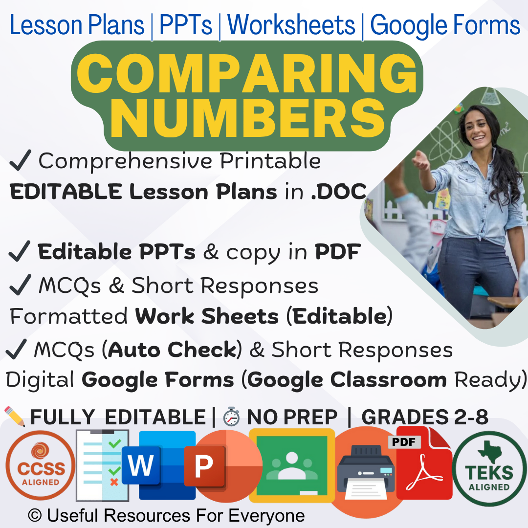
Reviews
There are no reviews yet.